Fire Modeling: What it is, How it is Used in Oklahoma and How it can be Improved
Fire modeling programs are used to capture the scope of fire severity, the fire spread rate and the perimeter estimates of wildfire and prescribed fire. A fire modeling program is a mix of many different projections that together can guide fire management agencies, land managers, emergency managers or property owners in making timely decisions whether during wildfire response or resource management efforts. Models are simplified reality and the simulation results could be associated with uncertainties. Therefore, land management decisions are often made with a combination of modeling and on-the-ground fire experience when possible. Fire models cannot completely match observed fire behavior given the variable fire environment inputs; however, they are often representative and can aid in identifying vulnerable or at-risk areas. For example, fire models can use a variety of weather condition inputs to look at fire behavior under worst-case weather scenarios and some models have maps or spatial outputs that can identify at-risk homes and communities.
Oklahoma Forestry Services uses a combination of fire models to assess wildfire risk and quickly identify at-risk areas. Fire models help with predicted fire behavior, guide OFS response efforts and enhance targeted postfire recovery. Programs currently used by OFS to model fires are FireSim Wildfire Analyst™ by Technosylva, Inc© and BehavePlus 6.0.0 developed by United States Forest Service, Rocky Mountain Research Station. FireSim Wildfire Analyst™ obtains fire incident data from both federal and state agencies, allowing the program to predict fire spread, boundaries and track existing fires in real time. This allows OFS to respond quickly and strategically during peak fire seasons. BehavePlus 6.0.0 is more often used in planning prescribed burns because it models fire behavior and not fire boundaries. It can better give a sense of general fire intensity under predicted weather variables. One of the key components of fire models is fuels. Fuel conditions are rarely uniform and vary across the fuelscape, transitioning from grasslands to shrubs to forests.
Even under constant weather conditions, fire behavior significantly differs from one fuel type to another. Fire models rely on standardized fuel models, which represent common fuel types on a national scale. For BehavePlus, there are only 40 standardized fuel models to simulate grasslands and forest types across the entire USA. Although 40 fuel models may seem like a lot, they can fail to capture regional variants in vegetation structure and composition. Examples include short sparse dry climate grass, low load dry climate grass and others. These are generalized categories and may not accurately reflect location conditions on a particular site.
Within Oklahoma there are unique temperature and precipitation gradients that result in transitions among ecological regions, including oak-pine forest, eastern deciduous forest, oak savanna, tallgrass prairie, mixed grass prairie and shortgrass prairie. This can result in difficulty modeling fires in Oklahoma at ecosystem transitions. In addition, these transitions are changing across the Cross Timbers ecoregion in Oklahoma, which complicates generalized fuel models. This region is typically an oak forest/savanna dominated by post oak (Quercus stellata) and blackjack oak (Q. marilandica). In the late 20th century the Cross Timbers has been encroached by eastern redcedar (Juniperus virginiana) and several hardwood tree species, where in the past with more fire, grasses and forbs constituted the understory (see Figure 1, Figure 2 and Figure 3).
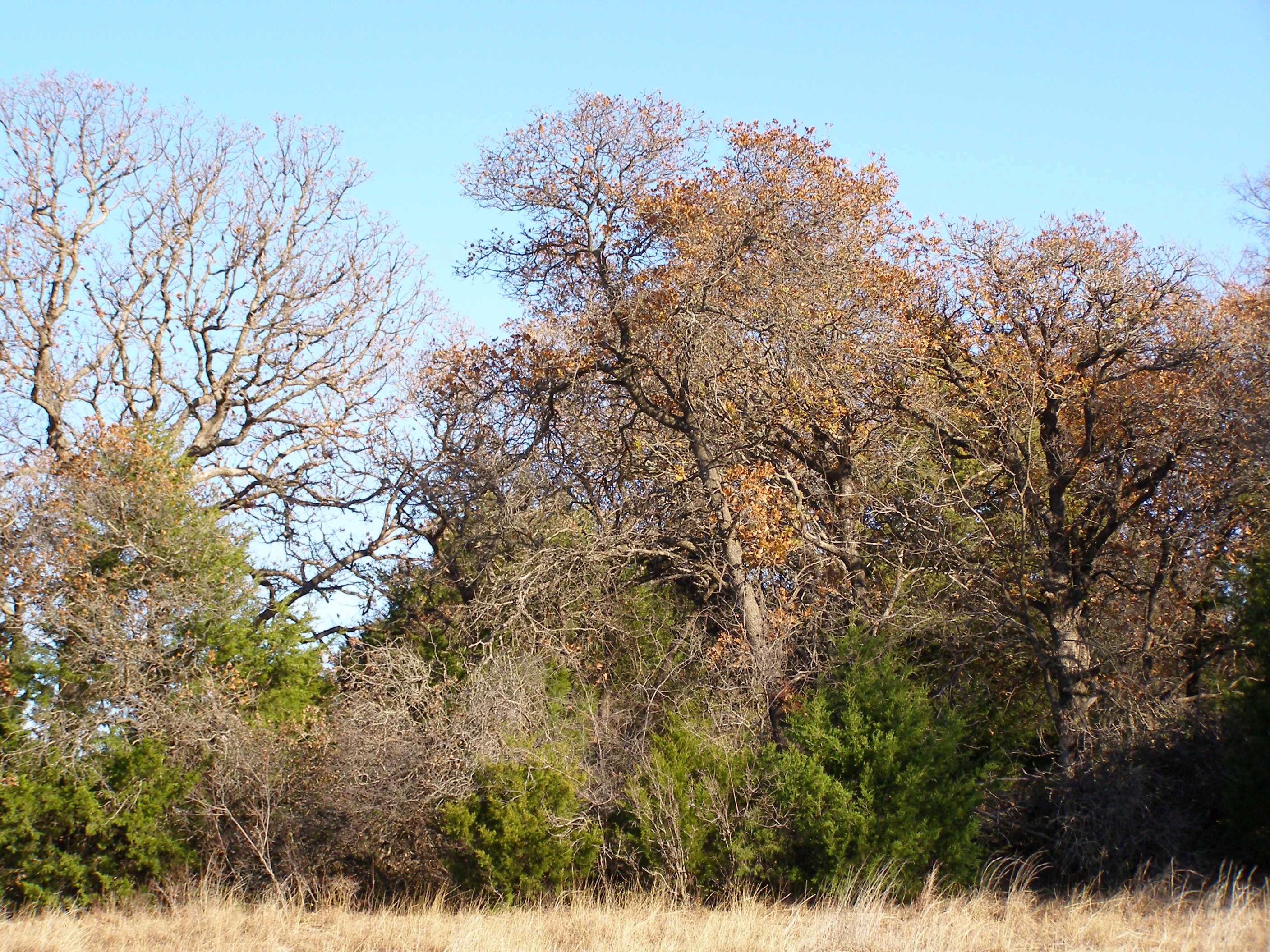
Figure 1. Eastern redcedar beginning to encroach periphery of oak-dominated Cross Timbers forest. Image courtesy of John Weir.
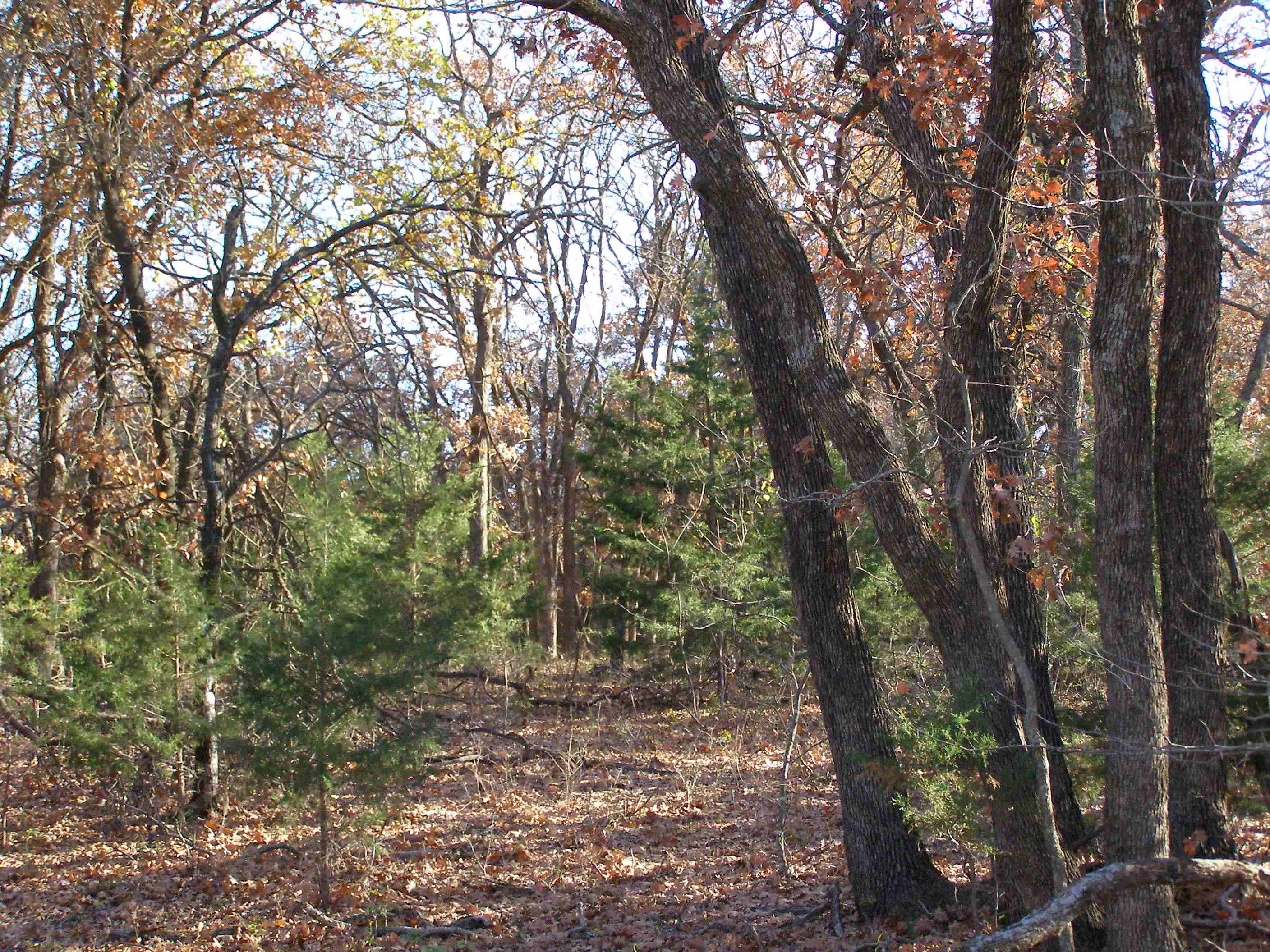
Figure 2. Eastern redcedar beginning to encroach in understory of oak-dominated Cross Timbers for-est. Image courtesy of John Weir.
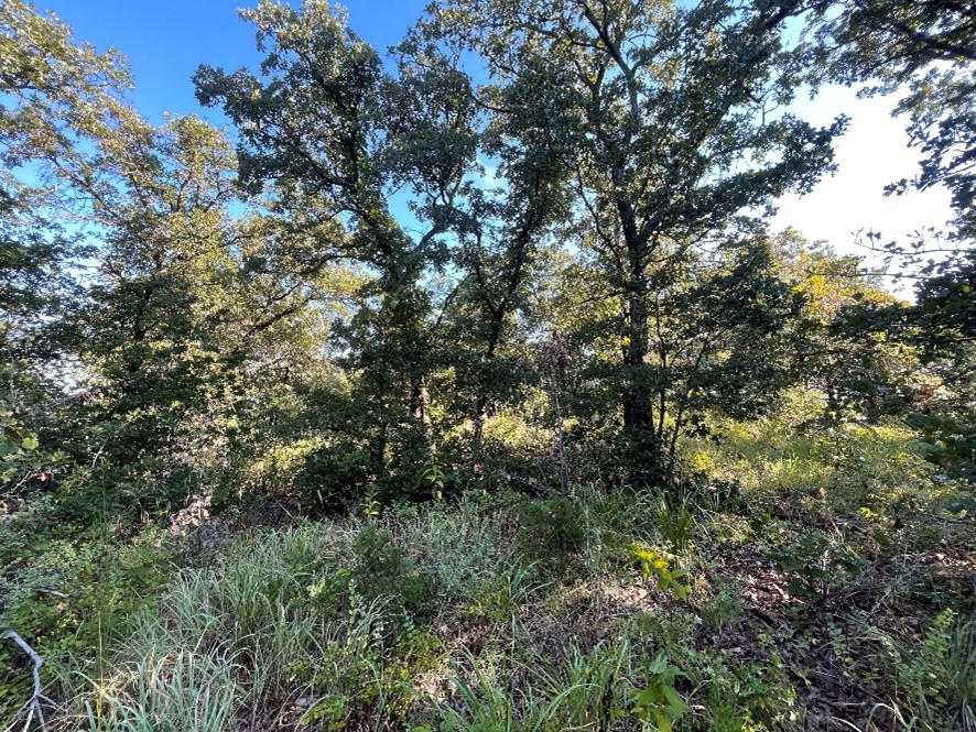
Figure 3. Oak-dominated Cross Timbers with grass nderstory. Image courtesy of Sydny Hager.
Cross Timbers forests are fire dependent and fire tolerant, but due to a decrease in fire since the early 1900s, fire sensitive woody species have been able to establish. For example, eastern redcedar, which is similar in drought tolerance to oaks and can establish beneath oak forest canopies due to its shade tolerance, has been able to successfully establish itself in many areas of Cross Timbers forest and in grasslands. In some cases, this has increased fuel load and resulted in many other environmental changes.
The forest type resulting from eastern redcedar encroachment is novel in that it is not well represented by any of the existing fuel models. When eastern redcedar encroaches into Cross Timbers forests, total fuel loading rises while surface fuels decrease. Eastern redcedar may add to ladder fuels that can bridge the gap between the ground and tree canopy (see Figure 4). Understory ground level fuels drop due to increased shade causing the loss of grass and herbaceous cover, which is replaced by eastern redcedar needles. Recent research has shown that eastern redcedar can reduce fire severity and reduce or stop fire spread under normal prescribed burn conditions (see Figure 5 and Figure 6).
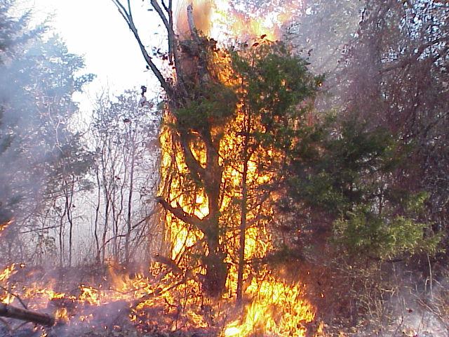
Figure 4. Eastern redcedar ladder fuels. Image courtesy of John Weir.
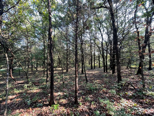
Figure 5. Closed canopy eastern redcedar encroached Cross Timbers with little understory fuels. Image courtesy of Sydny Hager.
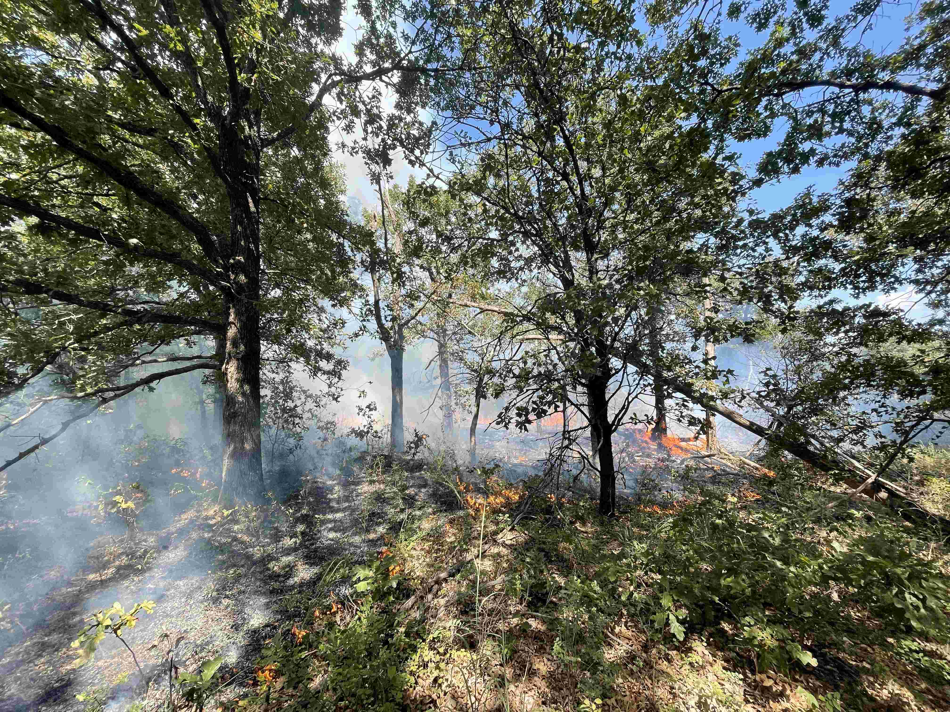
Figure 6. Sparse understory vegetation under closed canopy forests with eastern redcedar results in low intensity uneven burn behavior under normal prescribed fire conditions. Image courtesy of Sydny Hager.
However, under extreme fire weather conditions and drought, eastern redcedar can contribute to erratic to extreme fire behavior that is resistant to control (see Figure 7 and Figure 8).
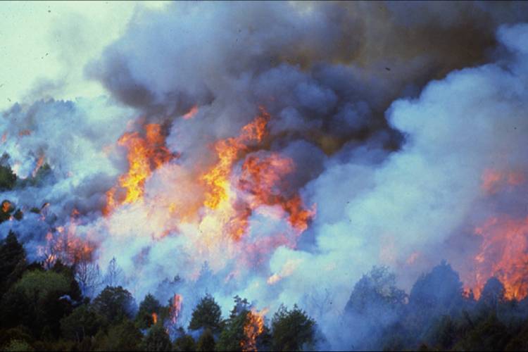
Figure 7. Extreme fire behavior in eastern redcedar. Image courtesy of John Weir
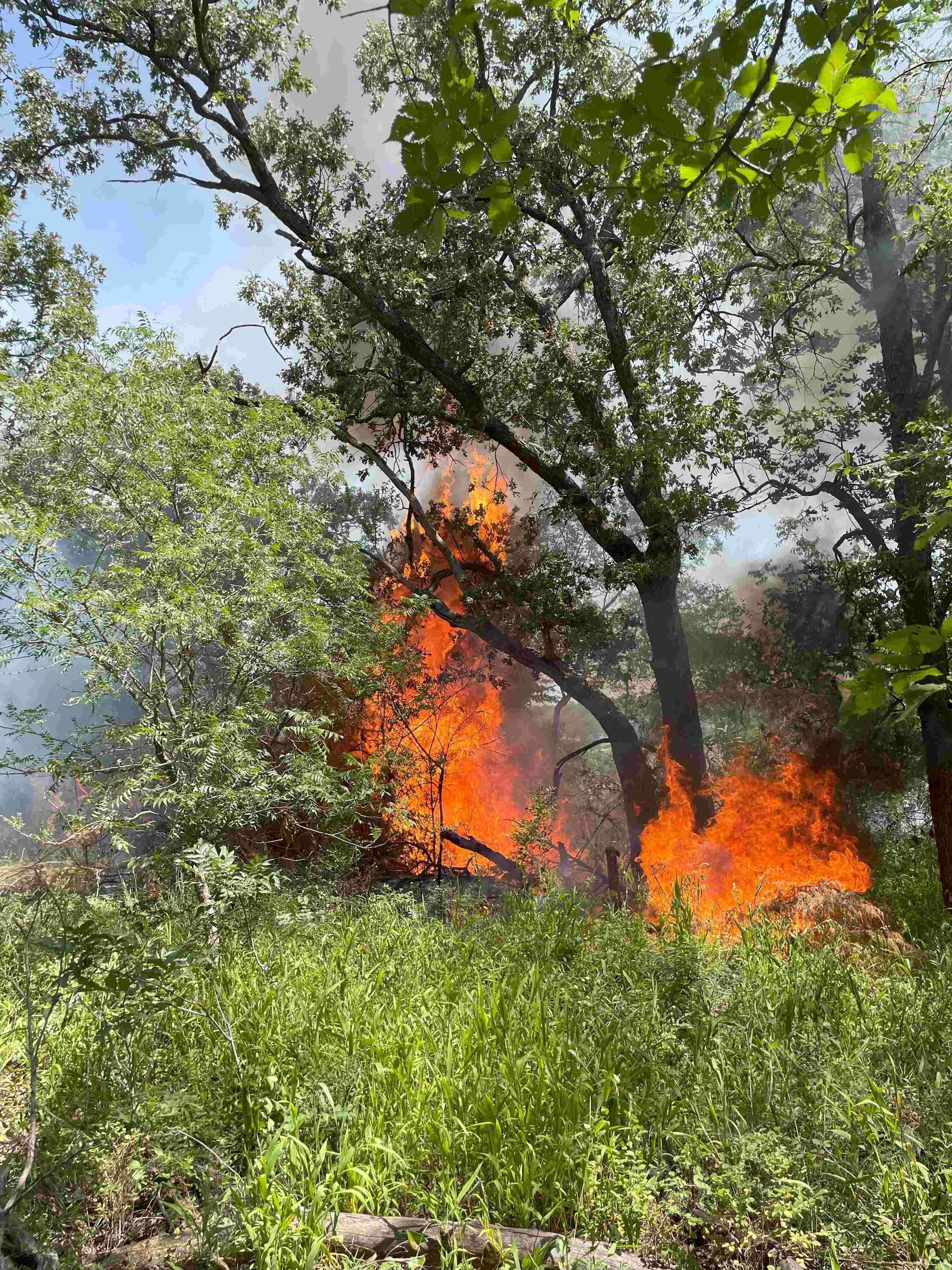
Figure 8. Dry eastern redcedar ignition can result in localized high intensity fire. Eastern redcedar can also bridge gaps between surface and canopy fuels under normal prescribed fire conditions. Image courtesy of Ryan DeSantis.
Therefore, eastern redcedar can either reduce or increase potential fire severity depending on conditions, which complicates fire modeling (see Figure 9).
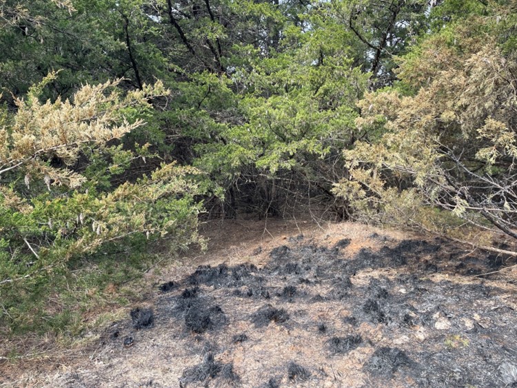
Figure 9. Photo from area burned by wildfire on March 14, 2025. Although eastern redcedar within 100 yards burned at high severity, this wildfire flank burned into a heavily encroached eastern redcedar woodland and stopped burning due to the wind direction and lack of connective understory fuels. Image courtesy of Sydny Hager.
Fires modeled in grasslands or in Cross Timbers forests without eastern redcedar are straightforward, compared to those vegetation types with eastern redcedar encroachment. Uniformity in grasslands or Cross Timbers understories with consistent vegetation make fire modeling comparatively simpler because these conditions have been studied and are well represented by models. Fire modeling in forests with eastern redcedar encroachment is relatively understudied and the fuel type has not been well documented with fire behavior forecasts largely based upon on-the-ground experience in the fuel type. OFS currently uses a combination of fuel models and reliance on extensive experience to assess fires within this specific fuel type. Other recent research has attempted to model fires in encroached areas to assess how well models capture fire behavior. Fuel models carefully chosen to match actual conditions can model average fire behavior in encroached areas under normal prescribed fire conditions. In cases where eastern redcedar is dry (due to mortality, drought or seasonality) and available as fuel, a California chaparral fuel model can capture the average maximum flame may not accurately reflect location conditions on a particular site. Within Oklahoma there are unique temperature and precipitation gradients that result in transitions among ecological regions, including oak-pine forest, eastern deciduous forest, oak savanna, tallgrass prairie, mixed grass prairie and shortgrass prairie. This can result in difficulty modeling fires in Oklahoma at ecosystem transitions. In addition, these transitions are changing across the Cross Timbers ecoregion in Oklahoma, which complicates generalized fuel models. This region is typically an oak forest/savanna dominated by post oak (Quercus stellata) and blackjack oak (Q. marilandica). In the late 20th century the Cross Timbers has been encroached by eastern redcedar (Juniperus virginiana) and several hardwood tree species, where in the past with more fire, grasses and forbs constituted the understory (see Figure 1, Figure 2 and Figure 3). lengths with comparative performance. However, these models only capture average flame lengths, and on a specific site, the modeled values are inaccurate (see Figure 10).
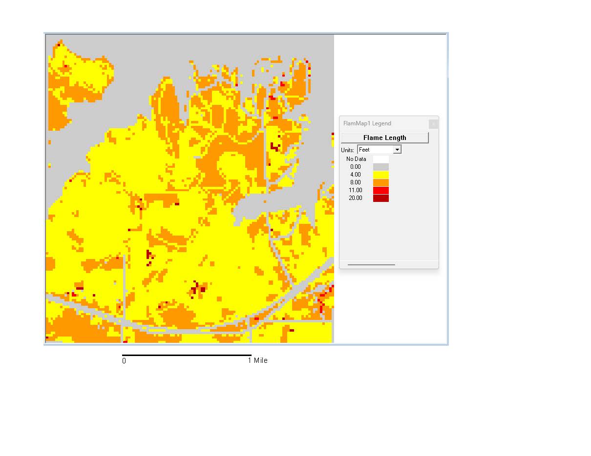
Figure 10. FlamMap model output showing generalized fire behavior on a coarse scale. This output indicates flame lengths for pixels approximately 323 square feet in size. In reality, the entirety of the 323 square feet would not burn at the exact same flame length. Image courtesy of Sydny Hager.
To identify site specific fire behavior or potential for fires, it is recommended to get expert guidance via a site visit. Modeling fires in eastern redcedar-encroached Cross Timbers is difficult and currently has many challenges. The lack of adequate local fuel models and the unpredictability of eastern redcedar fuels, especially considering weather conditions, contribute to guidance provided by forestry professionals. Continued changes in climate may exacerbate fire severity, risk and demonstrate the need for better modeling in this unique region.