

Urban Flooding: How Cities Manage Stormwater
Introduction
This fact sheet focuses on flood mitigation strategies implemented by city managers and engineers to protect people and urban infrastructure during floods. In urban areas, heavy rainfall is more likely to cause flooding because most surfaces are paved with low-infiltration-capacity materials, leading to rapid runoff generation, which can overwhelm stormwater systems with limited capacity to convey and store the excess runoff. Effective flood mitigation requires an integrated approach incorporating: (1) well-designed stormwater management infrastructure and (2) informed planning and policy. In the next sections, these two critical components of urban flood mitigation approaches are discussed and elaborated upon.
Stormwater Management Infrastructure
Stormwater management infrastructure can be categorized based on its primary function into conveyance, storage and runoff reduction/control systems, each playing a complementary role in managing urban flooding.
In most cities, urban stormwater systems are primarily composed of “gray” infrastructure to convey and store excess water. Increasingly, cities are also incorporating “green” infrastructure to reduce runoff volume and delay peak flows, particularly in flood-prone areas.
- Gray infrastructure uses built materials like concrete and pipes to control water.
- Green infrastructure uses natural elements like plants, soil and wetlands to absorb and manage water.
Conveyance Systems
Conveyance systems, also known as drainage networks, are critical components of stormwater management infrastructure that transport excess runoff across the landscape and through underground systems (Figure 1). These systems consist of gray infrastructure elements such as pipes, manholes, gutters, inlets and culverts designed to collect and convey stormwater efficiently.
At the surface, gutters/roadside ditches convey water to inlets or storm drains (rectangular grates or curb openings) set in the pavement. Culverts are installed beneath railways, roads and highways to convey runoff while preserving natural drainage pathways. Inlets drop flow into the underground network of pipes, while manholes (circular covers) provide inspection/maintenance access and connect pipe runs. The system discharges at an outlet to a stream, pond or basin. Proper sizing and maintenance are critical for effective performance. Undersized or clogged systems can overflow, causing street flooding and safety hazards such as hydroplaning.
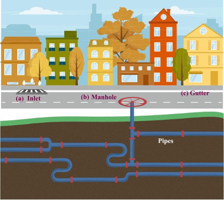 Figure 1. Main components of the urban drainage network in urban areas.
| Figure | Description |
|---|---|
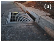 | Figure 1a. Storm drain inlet on the street |
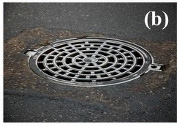 | Figure 1b. Metal manhole cover on a street |
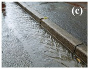 | Figure 1c. Rainwater flowing along a curb on a street |
Storage Systems
Detention and retention basins are two major engineered structures designed to store stormwater runoff and slowly release it through a controlled outlet to reduce downstream flooding (Figure 2). Detention basins, also known as dry ponds, are temporary storage structures designed to control flooding by reducing peak flows during flood events. Retention basins, known as wet ponds, however, are designed to permanently hold water and support both flood control and water quality benefits.
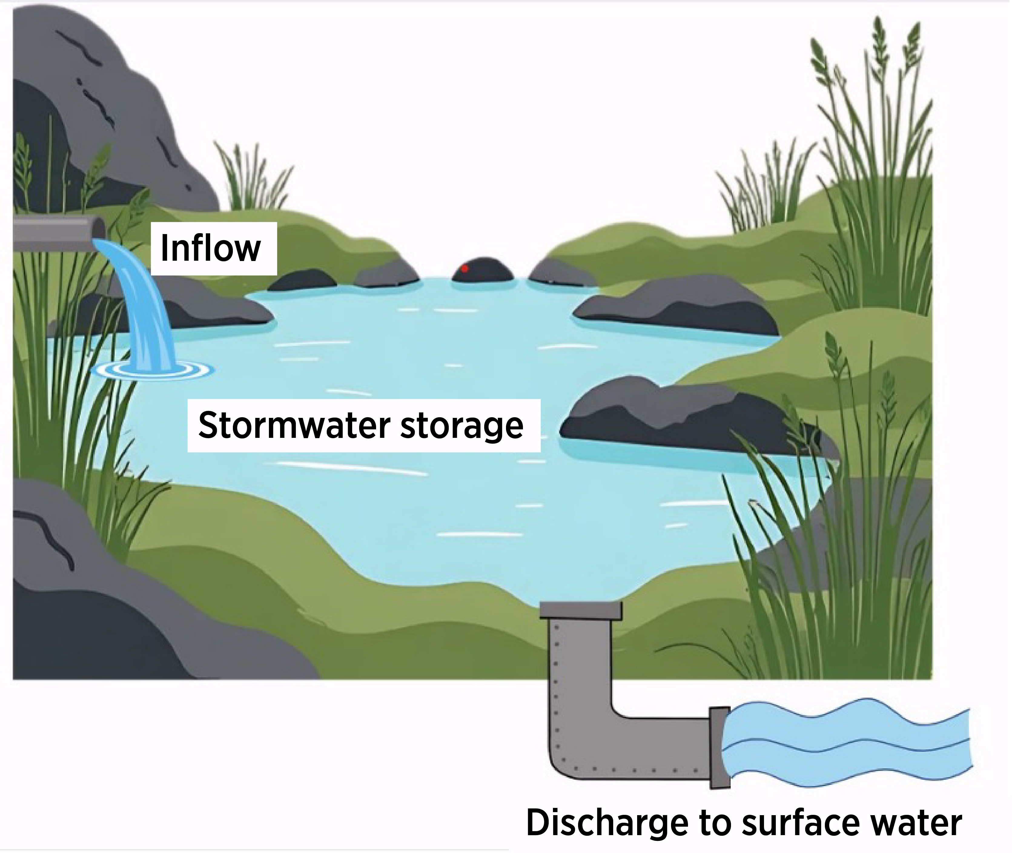 Figure 2. Graphic illustration of detention/retention basins used to store runoff.
Runoff Reduction/Control Systems
Runoff reduction/control systems, also known as green infrastructure, nature-based solutions or low-impact development (LID), aim to reduce stormwater runoff and delay peak flows by mimicking natural hydrological processes. These systems, which mainly promote infiltration, evapotranspiration and localized storage of runoff across multiple small-scale systems, also provide water quality benefits. Common practices include permeable pavements, bioswales, rain gardens and green roofs (Figure 3).
Planning and Policy Considerations
Effective flood mitigation depends not only on engineering design but also on how policies, regulations and programs are implemented across local, state and federal levels. Each level of government plays a distinct role in stormwater management, and their collaboration can help create flood-resilient communities across Oklahoma.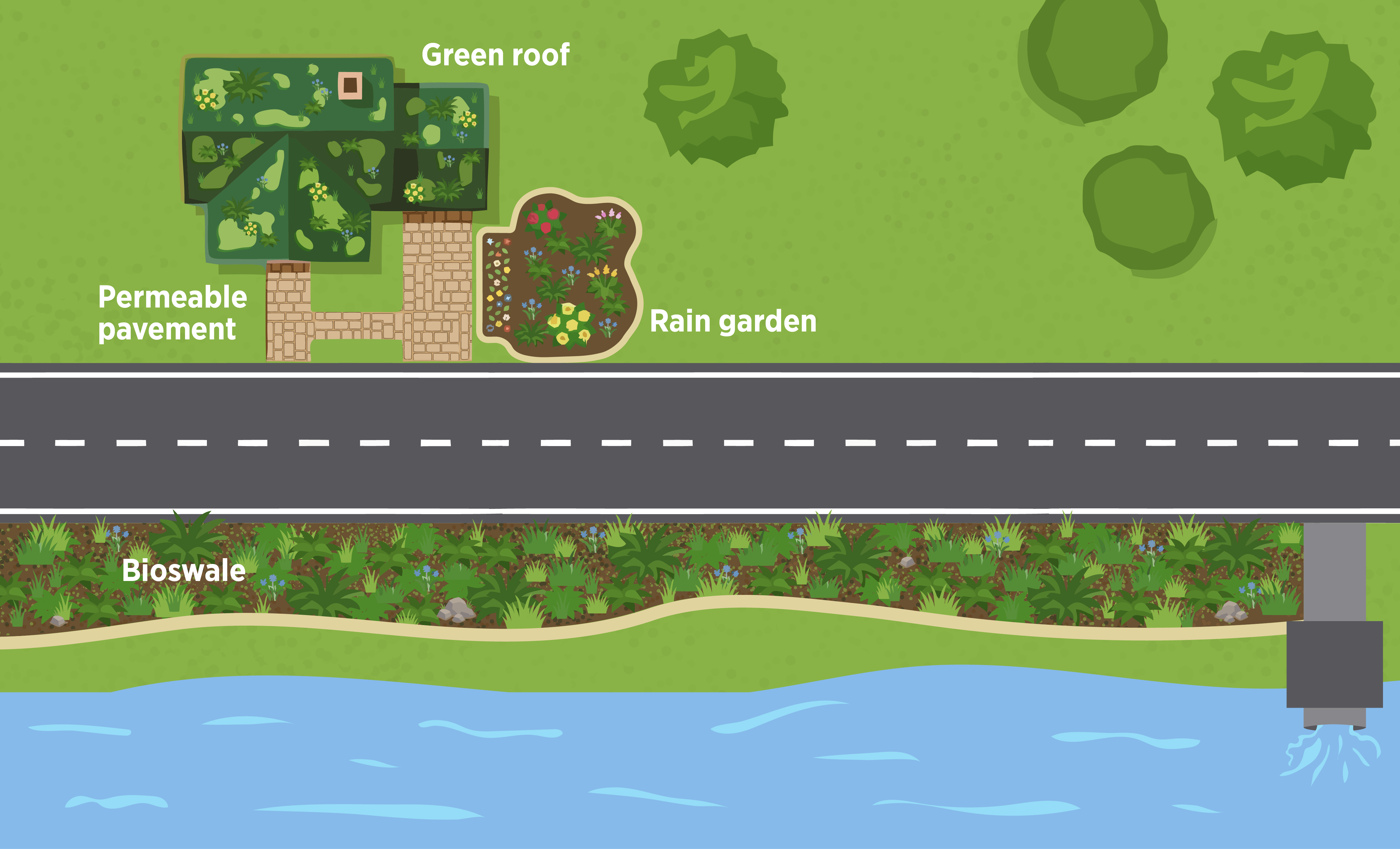 Figure 3. Green infrastructure practices used for runoff reduction and control. Green roof: Vegetation on rooftops reduces runoff and improves insulation. Permeable pavement: Allows water to infiltrate through the surface. Rain garden: Depressed landscaped area that captures and filters runoff. Bioswale: Vegetated channel that slows runoff, filters pollutants and promotes infiltration.
Local Government: Municipalities
Local governments are on the front line of stormwater and floodplain management. Cities and counties develop and enforce the regulations that shape how land is used, built and drained. Key responsibilities include:
- Adopting stormwater ordinances that regulate runoff from new developments.
- Operating and maintaining stormwater utilities and drainage infrastructure (culverts, detention basins, storm drains).
- Implementing Municipal Separate Storm Sewer System (MS4) permits to meet EPA Clean Water Act requirements.
- Requiring on-site runoff controls, such as detention basins, permeable pavements or rain gardens, in new construction.
- Administering local floodplain permits and reviewing development in mapped flood-prone areas.
Oklahoma cities, such as Tulsa, Norman, Edmond and Stillwater, have advanced stormwater programs that combine engineering design, land-use planning and community outreach. In rural areas, county governments coordinate with the Oklahoma Water Resources Board (OWRB) to administer floodplain regulations and support local emergency management.
State Agency: Oklahoma Water Resources Board (OWRB)
The OWRB Floodplain Management Program provides the foundation for statewide flood-risk reduction. OWRB works with local governments to help them comply with the National Flood Insurance Program (NFIP) and ensure that floodplain development meets federal and state standards. OWRB’s key roles include:
- Providing training and certification for local floodplain administrators.
- Supporting floodplain ordinance adoption and enforcement.
- Maintaining and updating statewide flood maps and risk data.
- Coordinating with FEMA on the Community Rating System (CRS) and flood mitigation planning (see below for more info).
- Offering technical assistance and outreach for small communities that lack full-time stormwater staff.
In addition to OWRB, the Oklahoma Department of Environmental Quality plays a critical role in stormwater management through its administration of water-quality regulations under the Clean Water Act. ODEQ implements the National Pollutant Discharge Elimination System (NPDES) Stormwater Program, which regulates stormwater discharges from Municipal Separate Storm Sewer Systems (MS4s), construction activities and industrial facilities. These permitting programs often drive the implementation of Low Impact Development (LID) and green infrastructure practices at the local level.
Through these programs, OWRB bridges federal guidance with local implementation, ensuring Oklahoma’s cities and counties can effectively manage their floodplains and stormwater systems.
Federal Partner: Federal Emergency Management Agency (FEMA)
At the federal level, the Federal Emergency Management Agency (FEMA) oversees the National Flood Insurance Program (NFIP) and supports communities in reducing flood risk through mapping, insurance and grant funding. FEMA’s Community Rating System (CRS) rewards cities that go beyond minimum NFIP requirements by implementing proactive flood mitigation and education measures.
FEMA also partners with agencies like the U.S. Army Corps of Engineers (USACE), which supports large-scale flood control infrastructure, and the U.S. Environmental Protection Agency (EPA), which oversees water quality regulations and stormwater permitting to:
- Provide technical guidance and hazard mapping (e.g., Flood Insurance Rate Maps (FIRMs), Base Level Engineering (BLE)).
- Fund mitigation and resilience projects under programs such as the Building Resilient Infrastructure and Communities (BRIC) grants.
- Support stormwater and water-quality initiatives that integrate flood reduction and ecosystem restoration.
These federal programs supply the regulatory framework and resources that enable local and state governments to plan, design and maintain resilient stormwater systems. Together, these agencies create a multi-level governance framework where flood risk reduction, water quality protection and land-use planning are closely interconnected.
Implications and Next Steps
Key Takeaways
- Urban flooding is primarily driven by increased runoff resulting from widespread impervious surfaces and the limited capacity of stormwater systems.
- Effective stormwater management infrastructure includes a combination of conveyance, storage and runoff reduction/control systems.
- Gray infrastructure primarily supports the conveyance and storage of runoff, while green infrastructure reduces and controls it.
- Stormwater system performance depends not only on design but also on coordinated policies, regulations and sustained maintenance at the local, state and federal levels.
Getting Started: Actions for Local Governments and Communities
- Reviewing and updating local stormwater and floodplain regulations
- Incorporating LID practices into new and existing projects
- Seeking technical assistance and training from state agencies
- Exploring state and federal funding opportunities for mitigation and infrastructure improvements
Key Contacts and Resources
- Oklahoma Water Resources Board
Floodplain management - Oklahoma Department of Environmental Quality
Stormwater permitting (MS4) and water quality guidance - Federal Emergency Management Agency
National Flood Hazard Layer (NFHL), National Flood Insurance Program (NFIP), Hazard Mitigation Assistance (HMA) program - United States Environmental Protection Agency
Green Infrastructure - United States Army Corps of Engineers